

08/11/2026
Today we are thrilled to report that several of our investigations into the statistics of crimes harming Epstein victims in California have converged into a damning report here.
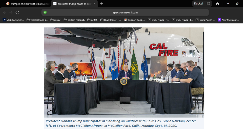
We begin with the photo above of Jeffrey Epstein's Donald Trump meeting with Gavin Newsom and Cal-Fire at McClellan Park terror cell.
Next we'll get right to it and lay out two statistical research projects that have converged, the first is a careful analysis into "firefighter arson" research after we determined that Cal-Fire employees were stalking and threatening Epstein victims in California with death, using government assets, proven by our second statistical research project. So we wanted to see if we could prove that Cal-Fire employees have been setting the fires resulting in them regularly flying on seemingly the same flight path, over and over and over again. So we knew that they were involved in crimes against the people of California, but now we can connect those crimes to crimes against Epstein victims in an amazing manner.
Here is how it plays out.
The following statistical research discovered a serial arsonist along the US-50 coordinator.
Directional pattern analysis of California wildfires
Bearing analysis from McClellan Park • CAL FIRE FRAP perimeter data, 2001–present
Summary
This report summarizes a directional/statistical analysis of California wildfire records since 2001, using McClellan
Park (Sacramento) as a fixed reference point. The analysis explores whether wildfires classified with cause code
“Arson” in CAL FIRE's Fire and Resource Assessment Program (FRAP) perimeter database show any distinguishing spatial or temporal pattern, focusing on a tightly bounded sub-cluster of fires bearing roughly east-northeast of McClellan Park.
The analysis finds a statistically unusual geographic tightness among 7 confirmed arson fires
in this sub-cluster, but does not find evidence sufficient to confirm a deliberate, coordinated, or single-actor
pattern. All findings should be read as exploratory and inconclusive.
Methodology
Wildfire perimeter data (n=8,712 records, 2001–2025) was pulled from CAL FIRE's public FRAP ArcGIS
FeatureServer, including each fire's centroid coordinates, year, cause code, and acreage. True compass bearing
from McClellan Park (38.66222°N, 121.40167°W) was computed for every fire. A data-driven density-clustering
approach (von Mises kernel density with cluster boundaries at natural density valleys, stable across a wide range of smoothing parameters) identified two broad natural clusters in the statewide data: a large Southeast-trending cluster (Sierra Nevada / Southern California) and a smaller, more diffuse Northwest-trending cluster (North Coast Range).
Within the North-to-East compass quadrant specifically, a further natural sub-split identified a tight, distinct
sub-population of fires bearing roughly 68–90° true (East-Northeast) from McClellan Park — referred to in this report as the E-leaning cluster (n=80 fires total, all causes).
Key findings
1. The E-leaning cluster's confirmed arson fires are geographically unusual
Of 80 total fires in the E-leaning cluster, 7 are coded Arson by CAL FIRE investigators. Using the convention East =
0°, North = 90°, these 7 fires have:
Metric Value
Mean path 16.6° (true bearing 73.4°)
Median 17.8°
Standard deviation ± 3.1°
Range 12.0° to 19.7° (7.6° total spread)
Years spanned 2002 to 2025 (23 years)
A Monte Carlo permutation test (10,000 random draws of 7 fires from the 80-fire cluster) found this spread to be
tighter than 97.5% of random draws — only 2.5% of random 7-fire subsets from the same cluster clustered this tightly by chance.
A linear regression of bearing against year found no significant temporal drift (slope = -0.04°/year, R² =
0.012, p = 0.818): the spatial band has remained equally tight from 2002 through 2025.
2. Road-access data is consistent with, but does not confirm, human origin
All 7 arson fires sit within 0.11–0.52 km of the nearest local road (including forest service roads and tracks, pulled
from OpenStreetMap), comparable to a 20-fire comparison sample of other-cause fires in the same cluster
(0.03–1.22 km). This rules out a lightning explanation for these ignitions but does not distinguish arson from other human causes (debris burns, equipment failure, campfires) — all of which similarly require road or trail access.
3. The pattern does not extend to a broader population
Expanding the population to include CAL FIRE's 15 “Unknown/Unidentified” cause fires in the same cluster (on the reasoning that undetected arson may disproportionately fall into this category) widens the mean path to 10.9°
(E=0/N=90) with a standard deviation of ±6.1° — statistically indistinguishable from a random draw (55th percentile in the same Monte Carlo test). The Unknown-cause fires' own mean bearing (8.3°) sits roughly 8° from the Arson-only mean (16.6°), indicating these two groups do not share the same spatial footprint. The tight, statistically unusual signal is specific to the 7 confirmed-arson fires and does not generalize.
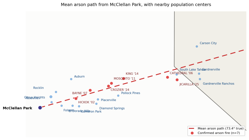
Map above: "Mean" arson path and nearby population centers
The dashed red line traces the mean bearing (73.4° true) of the 7 confirmed arson fires from McClellan Park. Population centers within 20 km cross-track distance of this path are labeled; town locations and 2020 Census population figures are drawn from public records. The mean path runs roughly parallel to, but consistently offset from, the populated Highway 50 corridor.
Interpretation and limitations
What this analysis supports: a real, statistically unusual geographic concentration of confirmed-arson fires in a narrow band east-northeast of McClellan Park, stable over 23 years, occurring in road-accessible terrain, and not simply an artifact of the cluster's overall geographic narrowness.
Later we took a look at the political affiliations 20 km on each side of US-50 to see if there was a pattern, and there was, mostly Republicans (red) along that pathway compared to Democrats (blue), and purple are swing voters.
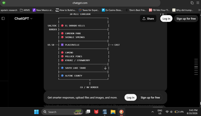
And so we are able to prove that the fire statistics we had AI process likely reveal a serial arsonist here, and one living primarily among Republicans, setting the forest on fire not far from roads in the area, and in a manner that resulted in Cal-Fire stalking and threatening our Editor, over and over and over again.
Then we explored firefighter arsonists, and found that one, Robert Hernandez of Cal-Fire had set not one, not two, not three, not four, but five fires around the homes of our Editor's mother and brother in Sonoma Valley.
To reconcile, Cal-Fire employees set five fires around the family homes of our Editor in violation of whistleblower peripheral rights conferred onto our Editor's family members. And we have identified another arsonist who has set 7 fires outside of our Editor's home, resulting in Cal-Fire government assets being flown way off course to our Editor's home, when Cal-Fire pilots dive bombed our Editor's home, and/or accelerated towards the same, in a manner we can prove with statistical intent is stalking and death threats, as follows.
Approximately 100 firefighters get caught setting fires per year per Wikipedia on firefighter arson, a lot of them basically described as losers who need others to perceive them as heroes is what the research found, so they set CA on fire, and then bask in the glory of the public, whose tax dollars they pocket, while burning down homes and/or killing others, for example in the case of Cal-Fire's Robert Hernandez.
And so before drinking the cool aid on all the pro-Cal-Fire propaganda, makes sure they or their employees didn't set your community on fire, because that is what they have provably done to our Editor's family, and in doing so have actually harmed our Editor, a victim of Jeffrey Epstein for 24 years.
And so now we'll pair that with statistical intent proving stalking and death threats with deadly weapons here.
Very simply, for about 10 years Jeffrey Epstein's living in Rocklin, CA, have been stalked and terrorized by local law enforcement, local military, and local fire in conspiracy with Jeffrey Epstein's contractors operating out of McClellan Park, stalking and intimidating Epstein victims, to ultimately RICO obstruct justice for Epstein's victims, specifically our Editor and his family, in 5 to 11 separate locations, also provable statistical intent.
And so the findings of the statistical intent tool above, reveal an intent by Cal-Fire and USDA Forestry conspirators of Jeffrey Epstein, involved in stalking and death threats against our Editor and his family, as follows, and where the findings of this statistical research report are simple. One stalking and death threat event may be accidental, the second stalking and death threat event is the beginning of a pattern, and the third stalking and death treat or more, and the pattern is proven beyond all reasonable doubt.
We can 100% the statistical intent of both Cal-Fire criminals and USDA criminals, who have yet to be prosecuted, because of all of the bipartisan RICO obstruction of justice against Epstein victims by CA and USA governments.
We begin with evidence that those working with Robert Fernandez at Cal-Fire in Healdsberg, where Fernandez set fires by our Editor's family home, to Cal-Fire from Healdsberg joining the conspiracy to stalk, intimidate, and threaten with death to RICO obstruct Epstein victims. This Cal-Fire pilot flew directly from Healdsberg to the family home of our Editor in Rocklin, CA. This is why we document this stuff, as otherwise it would come off as unbelievable, but again, we only deal in facts and reasonable inference.
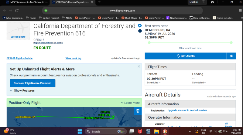
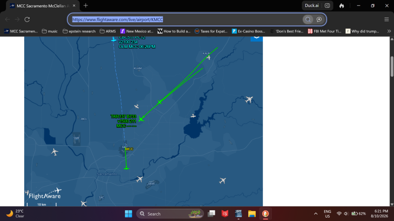
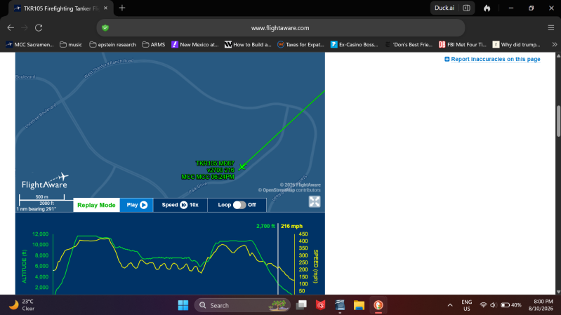
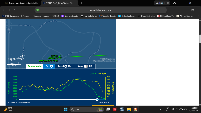
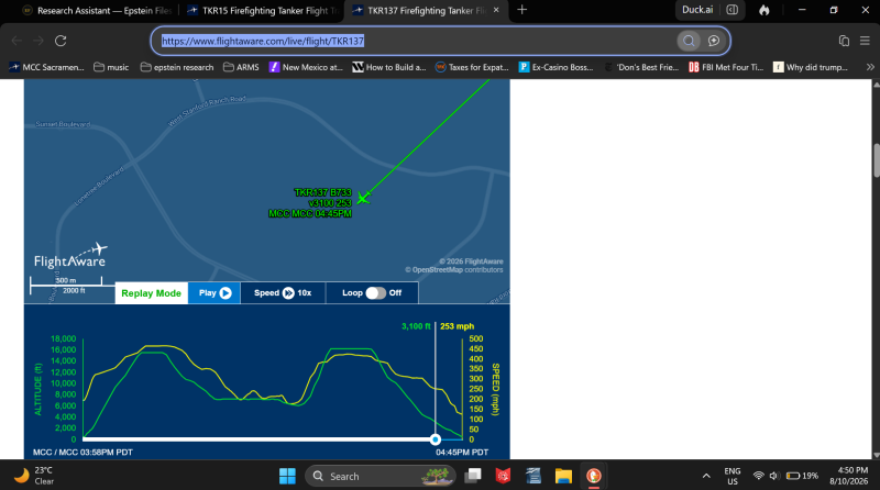
More simply, we only have to prove three times that Cal-Fire (Gavin Newsom) and/or USDA/US Forestry (Donnie Urine Mints) flew off course, divebombed, and/or accelerated enormous vehicles towards the home and family of our Editor in Rocklin. Except we can prove more than 3 times, and so intent proven, and these are just the most recent attacks, beginning with this double attack on our Editor's community. Except in this situation, we only have to prove the attack once, because of the circumstances linked to flying so far away to our Editor's home, AFTER we accused Cal-Fire of being involved in ongoing crimes for Jeffrey Epstein's crimes syndicate in conspiracy with them. This is provable stalking, intimidation, and retaliation against an Epstein victim and Epstein-Russia whistleblower.
Here's a double attack by Cal-Fire on roughly the same arson pathway, is not coincidence, but a pattern, and here are the otherwise three attacks by Cal-Fire required for us to sue them for $500 billion in pairs in conspiracy with Robert Hernandez, and Jeffrey Epstein, and then all the others we can also prove too easily, or in legal terms evidence well beyond a reasonable doubt.
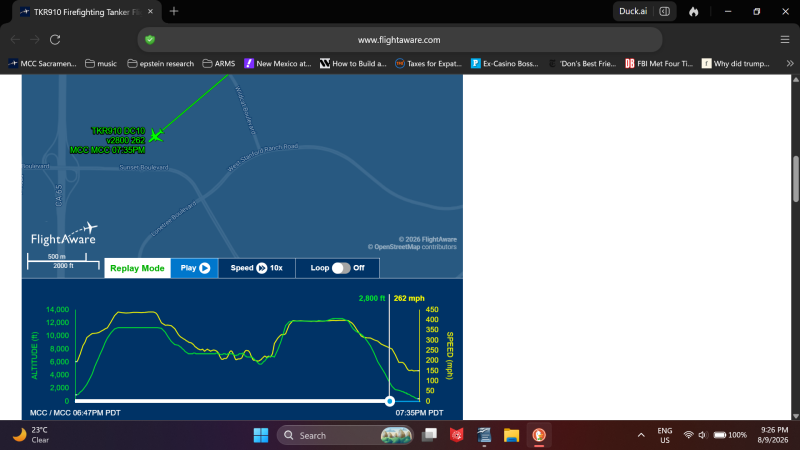
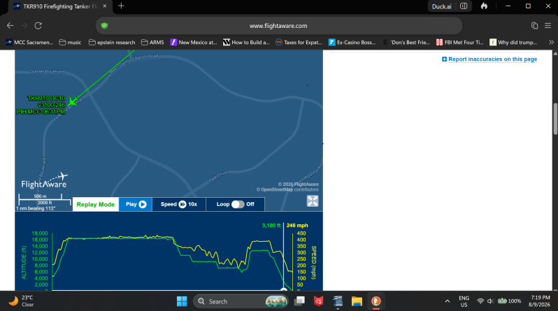


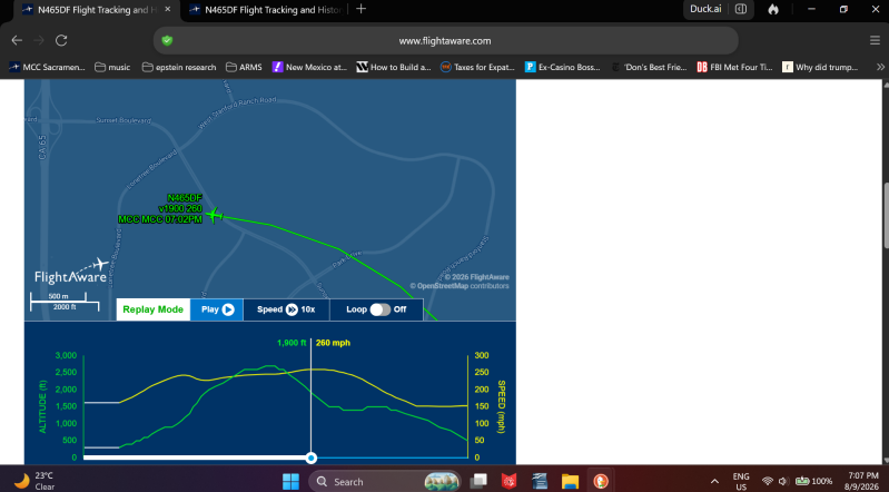
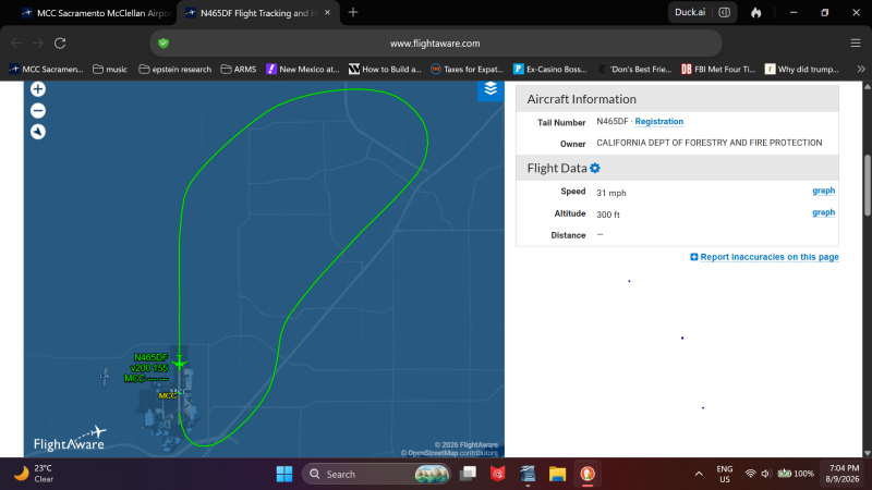
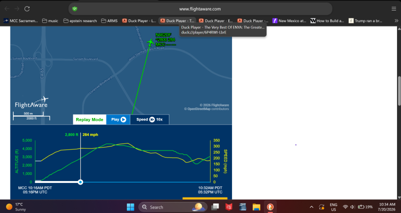
Here's another double attack.
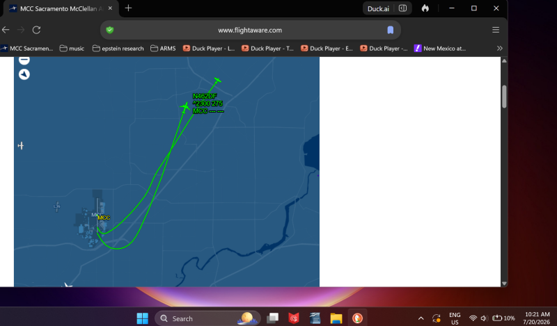
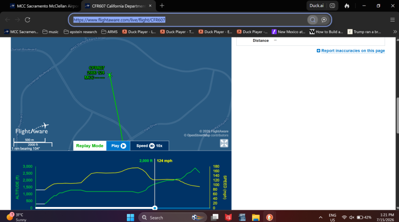


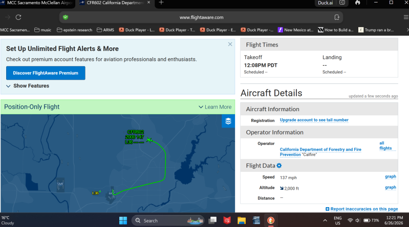
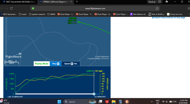
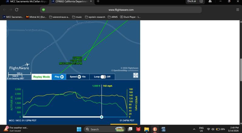
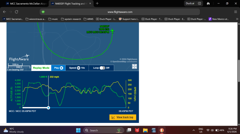
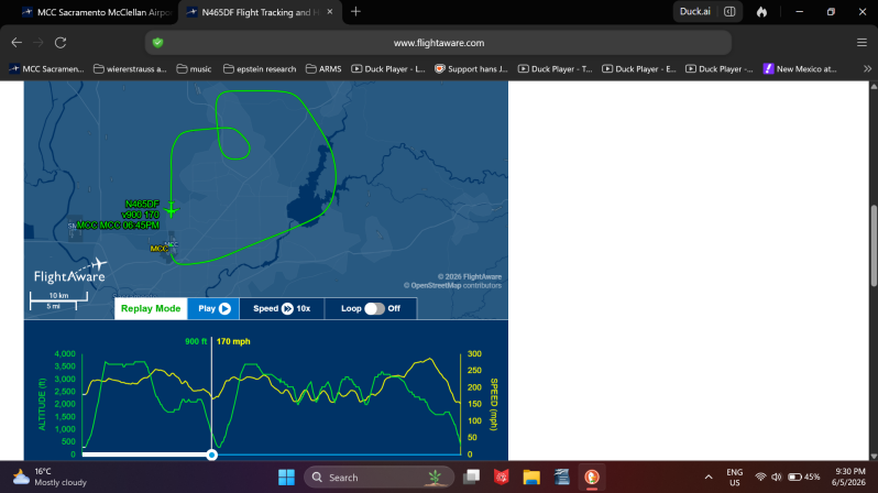
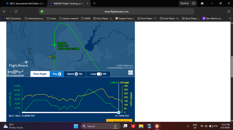
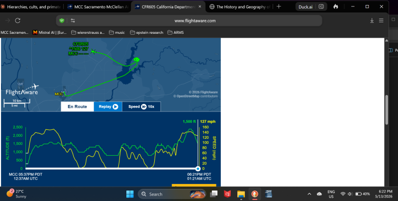
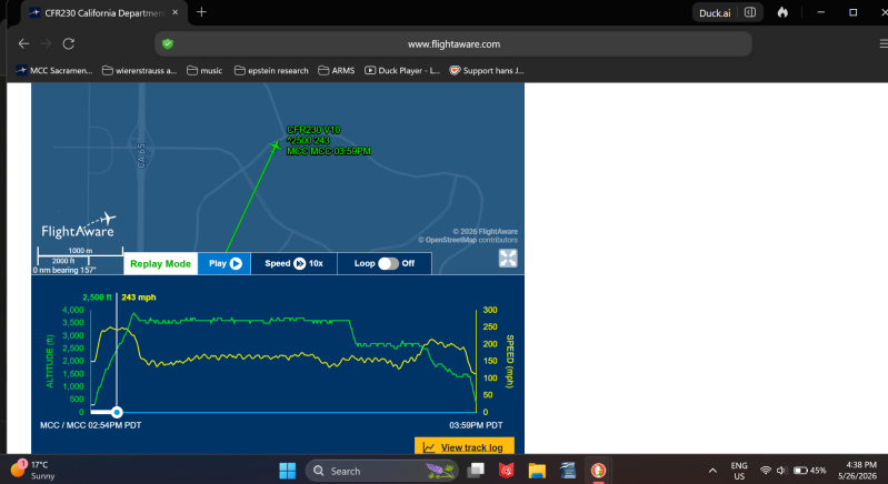
And so the reasonable inference here is that Cal-Fire firefighters have been engaged in arson directed at the family of an Epstein victim, have already been caught 5 times setting fires by the homes of the mother and brother of our Editor, and stalking, intimidating, and threatening Epstein victims with death by flying militarized government assets way off course, as often as possible, then divebombing the vehicles to turn them into weapons, and/or accelerating towards the family home of our Editor, while responding to no fewer than 7 to 22 fires by our Editors home, and where the reasonable inference is that Cal-Fire firefighters have set these fires also, based on statistical analysis of these overlapping patterns. So next time California burns, it could be Cal-Fire setting those fires, so that zeroes can pretend to be heroes.